NCI Australia, Australia’s national research computing service, and Geoscience Australia this week launched a new tool for viewing very-high resolution satellite imagery of Australia.
The viewer is part of a broader initiative involving a group of Australian research infrastructure organisations to bring together a vast collection of previously incompatible geoscience datasets that scientists can use to improve our understanding of the Earth beneath us.
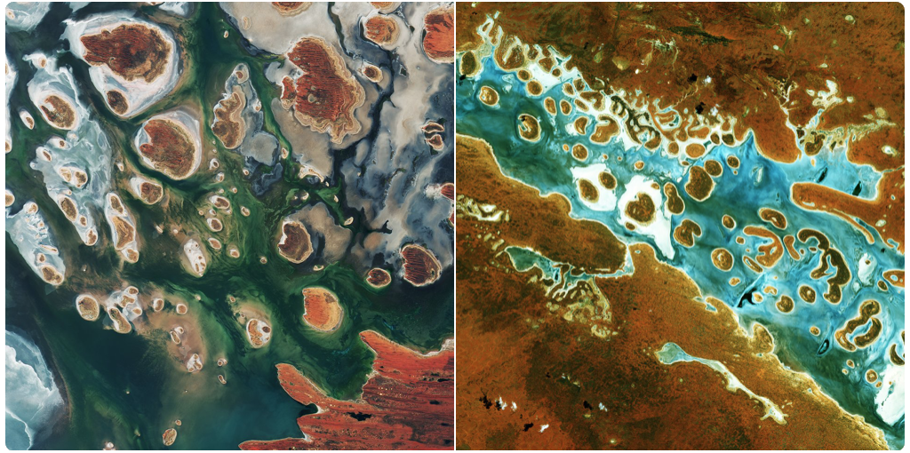
Lake Mackay and Lake Amadeus. Geoscience Australia, Copernicus EU, ESA Earth Observation and NCI Australia
These images of Lake Mackay (left) and Lake Amadeus (right) were captured by the Sentinel satellites whose data is now even easier to access through the new portal, SARA.
SARA provides free access to data from all Sentinel satellites for the South-East Asia and South Pacific region. The Sentinel missions are part of the Copernicus programme that is coordinated and managed by the European Commision. The data products are generated by the European Space Agency and the European Organisation for the Exploitation of Meteorological Satellites. SARA is hosted at the National Computational Infrastructure and operated by the Regional Copernicus Data Hub consortium formed by Geoscience Australia, the New South Wales Office of Environment and Heritage, Queensland Department of Science Information Technology and Innovation, Western Australian Land Information Authority and the Commonwealth Scientific Industrial Research Organisation. Portal users currently have access to more than 2,387,403 products.