The U.S.A. National Sciences Foundation (NSF) asked 2200 Americans 10 questions to test their general knowledge of basic physical and life sciences in 2012. The results of the 2012 survey were included in a major report, Science and Engineering Indicators 2014, presented to the U.S. President and Congress.
The NSF plan to repeat the survey in the USA in 2014. The survey has also been recently put to the general public in the USA, China, the EU, India, Japan, Russia, Malaysia and South Korea.
How does the general knowledge of Australians compare? Complete the survey here (10 multiple choice questions) to help find out. On completing the survey you will be redirected to a link that presents the survey results for the USA and other countries.
The survey is open to anyone to complete – feel free to share this with your friends and colleagues.
22 Feb 2014
Geology plays an essential role in many areas of the economy. economic growth and sustainability, as well as societal wellbeing, will require reliable supplies of energy and mineral resources, a dependable supply of clean water and the secure and sustainable production of food. All this will be contingent on sustained investment in technology, infrastructure, education and skills development.
A new report prepared by the Geological Society of London, “Geology for Society” which examines the many and varied contributions of geosciences to modern communities.
It outlines many of the ways in which geology is of value to society. Geology underpins the provision of most of the resources on which the population and industry of developed countries depend, including energy, minerals, water and food.
Many vital services also depend on geology, including management of the waste we produce; ground engineering for the construction of buildings, roads, dams, tunnels and other large infrastructure projects; and remediation of a wide range of environmental problems, including land contaminated by industrial use.
The report provides an overview of each of these essential areas and highlights the importance of ensuring a skilled geoscience workforce and strong research base, to equip society to face the unprecedented challenges of the 21st century.
The report os aimed at policy and decision-makers as well as the wider public and is as relevant to readers in other countries as those in the U.K..
12 Feb 2013
The latest instalment in the AIG Australian Geoscientist Employment Survey series is open for contributions until 28th February.
These surveys were commenced to track the impact of the global economic downturn on geoscience employment in 2009 but have since demonstrated the ability of geoscientist employment trends to foresee upturns and downturns in the fortunes of Australia’s exploration and mining industries and provided invaluable data for presenting the impact of government policy decisions on exploration and mining activity.
The format of the surveys has been kept consistent for much of this period to help ensure that data is comparable from one survey to another. The ongoing success of the survey series depends directly on your support. The surveys are being conducted each quarter at the moment due to the dynamic employment conditions evident for geoscientists in Australia.
The minute or two that it takes to complete the survey makes a difference.
Please contribute to the institute’s work in the employment field by completing the survey before the closing date and encouraging your colleagues and friends to contribute. You do not have to be an AIG member to participate.
FameLab is run in 23 countries around the world and adds an international element to Fresh Science with the national winner heading over to the UK to present at The Time Cheltenham Science Festival.
FameLab state finalists will be invited to take part in a one day media and communication training workshop, run by FameLab Presenting Partners, Fresh Science.
The workshop will help state finalists feel more comfortable in talking with journalists and give them more control over their media appearances.
Over the day, state finalists will learn how to see the story in their science, which is a skill useful not just for the media, but also for grant applications, talking to other stakeholders and even down at the pub!
Then state finalists will deliver a three-minute presentation at a public event in front of a panel of three FameLab judges.
We’re looking for passionate early career researchers with a peer-reviewed discovery to present their science as part of the inaugural FameLab Australia – a new competition presented by the British Council, Cheltenham Festivals and Fresh Science.
The competition builds on Fresh Science, but with a twist.
Plain speaking is essential. Music, song, poetry and props are optional.
Applicants can be honours students, graduate students or up to 5 years post-PhD, and researching in any field of science, maths or engineering.
FameLab Australia will add an international element of performance to the existing Fresh Science program, which celebrates the achievements of early career researchers and shares their work with media and the public.
Up to 60 early career researchers will be chosen to join us at state finals across Australia, where they will:
The top two from each state final will jet over to Perth for the national final.
Over four days, they’ll perfect their pitch with help from experts in communication and presentation, and we’ll tell the media and science community about their work.
The winner of the national final will head to the UK to represent Australia at the FameLab International Grand Final, at the Times Cheltenham Science Festival in June.
To apply online, and for key dates and selection criteria, head to: www.famelab.org.au
FameLab is an initiative of The Times Cheltenham Science Festival. FameLab Australia is presented by the British Council, Cheltenham Festivals and Fresh Science; and supported by Inspiring Australia, the Western Australian Museum and the British High Commission, Canberra.
9 Feb 2014
The American Geosciences Institute (AGI) has been tracking the gender of geoscience degree recipients in the USA for a number of years.
Recently released figures show that the total number of women receiving geoscience degrees in the USA is rising, following a long term growth trend. In 2013, 44% of geoscience PhD graduates were women, who also accounted for 41% of bachelor’s andf 42% of master’s degrees.
This AGI Geoscience Currents briefing provides further information.
Comparable statistics are less readily available for Australia.
AIG is an affiliate of the American Geosciences Institute.
9 Feb 2013
The future direction of AIG News is currently being examined by a Council committee which will examine a number of issues including:
The current plan is to introduce changes to AIG News from mid-year (August). A survey to collect members’ views on a number of topics is available for members to complete here. The survey will remain open until 21st March 2014.
Members are also welcome to contribute ideas and suggestions by contacting AIG’s Executive Officer, Lynn Vigar by email.
There is also a discussion thread on this issue on AIG’s Linkedin Group. Members are welcome to join the discussion.
Geological Interpretation of Aeromagnetic Data
The Australian Society of Exploration Geophysicists (ASEG) has released a new e-book “Geological Interpretation of Aeromagnetic Data” by Dave Isles and Leigh Rankin.
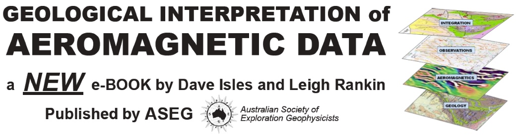
This book aims to help geologists to extract maximum value from aeromagnetic survey data. It shows how to integrate these data with geological data to build an interpretation that matches the objectives of your project. The book is written by two consulting geoscientists who deal with complex geophysical and geological interpretation problems in their day-to-day work.
The authors have prepared the book in response to the frequently cursory analysis of high-quality aeromagnetic data, usually caused by the absence of geologists’ active participation in the integration and interpretation process. They have seen the value of many datasets seriously eroded by under-use. Surveys costing $500 000 or more sometimes attract only a handful of days of interpreter time for assessment. Aeromagnetic data contain a wealth of geological information that may be overlooked if the analysis is con-strained to the ‘geophysical’ aspects and confined to geoscientists with predominantly geophysical training and a focus on the physics and mathematics of the data. The examples in this book show the level of geological detail and consequent exploration value that can be gained from adequate, well-focused time spent analysing aeromagnetic data.
Dave Isles is a geophysicist by training who has spent most of his 40-year career using aeromagnetic data (and many other geophysical tools) to facilitate mineral explora- tion programs. His grasp of geology has grown through the need to fully understand the geological environ- ment of each new exploration project. Leigh Rankin is a geological mapper with specialist structural skills. He began using aeromagnetic data in South Australia during the 1980s when he discovered that just beneath the vast expanses of sand dunes, swamps and alluvial plains, there were rocks with readily measurable mag- netisation. Beneath the paddocks of wheat and sheep, these rocks could be mapped both individually and collectively by using aeromagnetic data, thus aiding the assembly of geological interpretations at all scales.
The authors emphasise that the main ingredients in a high-quality interpretation are astute use of the geoscientist’s brain and adequate time, not only to digest diverse clusters of data, but to integrate these into a working map that drives our project forward. The rewards for this (usually modest) effort and time can be substantial – a resource discovery, a quantum leap in understanding of local geological evolution or a new direction and momentum in exploration, to name a few.
The book has evolved from a short course created to address the demand from exploration geologists who, faced with an explosion of high-resolution aeromagnetic data in the Australian gold and base-metal prov- inces in the early 1990s, recognised the need to take ownership of the interpretation function on their project areas. Simply put, there were too few suitably experienced geoscientists then, to assist with the exciting task of integrating this wealth of new data into exploration programs. Hence the book has its roots mainly in gold exploration in Australia (as reflected in much of the imagery used in the examples), but the authors have since expanded the methodology to embrace the interpretation of aeromagnetic surveys in a wide range of ‘hard- rock’ and ‘soft-rock’ applications. The methodology described in the book is considered to be appropriate for mineral and hydrocarbon explorers, as well as groundwater explorers, and in fact all those involved in producing and using integrated geoscientific maps.
The book stresses the value of data integration; not only of geological and aeromagnetic data, but also radiometric, satellite imagery, aerial photo, gravity, electromagnetic and of course seismic reflection data where these are accessible for the project. Because of the diverse and consistent range of geological information it provides, our prime focus in this book is on ‘aeromagnetics’.1 We stress, however, that all available data should be considered when compiling a working interpretation. The cornerstones of the integration process are formed by the wonderful GIS, imaging and modelling tools at our disposal for enhancing and cross-referencing datasets, but the diligent and experienced human brain is the tool that shapes the end result and determines its quality. The tasks of observation, integration and interpretation that we describe in this book involve mostly simple and qualitative steps, using much more geological reasoning than heavy-duty physical or numerical analysis.
Click here to view the book’s Contents pages. An order form for the book is available here.
7 Feb 2013
Enrollments in U.S. geoscience programs remained robust during the 2012-2013 academic year. Though total enrollments retreated from their 2011-2012 highs, the drop in enrollments was less than 3%. The current enrollment trend likely reflects the strong employment outlook for geosciences relative to the continued weak U.S. job market.

U.S. Geoscience Enrolments, 1955-2013
Reports from many geoscience programs around the U.S. indicate that they are at or near capacity, and thus additional enrollment growth above the current levels is unlikely without either a major expansion at existing programs or the introduction of online geoscience degree programs.
Total enrollments in 2013 were 27,591 undergraduates and 10,935 graduate students.Degree production at U.S. geoscience programs also remained strong. Undergradute degrees awarded continued to increase, reflecting the recent run-up in undergraduate enrollments. The sudden increase in Master’s degrees awarded in 2012 does not appear to be an anomaly. Even though awarded Master’s degrees have dropped, they remain above the levels seen since 1987.
This increase in Master’s degrees is likely in response to the strong job market, with an increasing number of students pursing geoscience graduate degrees to improve their employability. In addition, the large number of Master’s degrees awarded could also be attributed to Ph.D.-tracked students opting to graduate with Master’s degrees – excited for job opportunities outside of academia, given the extremely competitive job market in pure research and academic fields.
The total degrees awarded in 2013: 3691 Bachelors, 1313 Masters, and 663 Doctorates.
American Geosciences Institute
5 Feb 2014
Snowden are offerring AIG members a 10% discount on training courses.
The extensive range of courses offerred by Snowden are presented in a number of locations globally, including Perth, Brisbane, Johannesburg, Vancouver, Toronto, Singapore, Hong Kong, Jakarta, Belo Horizonte and Ulaanbaatar.
The course schedule for January to July 2014 is available here.
Quote your AIG membership number when registering to receive the discount.

Canada’s Association of Professional Engineers and Geoscientists of British Columbia (APEGBC) has published a position paper on climate change as it relates to the professional practice of engineering and geoscience. The position paper, developed by APEGBC’s Climate Change Advisory Group (CCAG) outlines the association’s position on the changing climate in BC, as well as the implications for practicing professionals. APEGBC members play a key role in providing guidance and advice to decision makers on how to respond to climate change, given their technical expertise and commitment to public safety.
APEGBC’s position statement on climate change is as follows:
A. APEGBC recognizes that the climate is changing and it commits to raising awareness about the potential impacts as they relate to professional practice and to providing information and assistance to members in managing implications for their own professional practice.
B. APEGBC members (professional engineers, professional geoscientists, provisional members, licensees, limited licensees, engineers-in-training and geoscientists-in-training) are expected to keep themselves informed about the changing climate, and consider potential impacts on their professional activities.
Several resources are provided in Canada to assist professional geoscientists in understanding and addressing the potential impacts of a changing climate on their professional practice, including: Professional Practice Guidelines, and the National Survey of Canada’s Infrastructure Engineers about Climate Change.
The Position Paper on Climate Change was approved by APEGBC Council and developed by APEGBC’s Climate Change Advisory Group (CCAG), following consultation with a number of APEGBC committees. The CCAG is responsible for advising APEGBC Council on matters related to climate change based upon the duties and objects set out in British Columbia’s Engineers and Geoscientists Act.
The Position Paper on Climate Change is available on APEGBC’s website: www.apeg.bc.ca/climate-change.
2 Feb 2014