
Unlocking the mineral secrets of Papua New Guinea, the long-term evolution of the Earth and using drones to map past climate change are just a few of the projects to win funding under the Australian Geoscience Council (AGC) and the Australian Academy of Science’s inaugural geoscience travel grant scheme.
Eleven early-career geoscientists from Australia and New Zealand will share a total grant funding pool of $30,000 to support their world-class research overseas.
AGC President Dr Bill Shaw said: “We were overwhelmed by the number and quality of applications. We have awarded grants to support work that impacts on a variety of geoscience disciplines, from astrobiology to magma transport in volcanoes and how it impacts on volcanic hazards and ore deposit formation.”
Geoscientist Dr Phil McFadden, who represents the Academy on the travel grant scheme, said: “Geoscience is a global endeavour and it is important for early-career researchers to have the opportunity to study rocks in diverse environments if they are to make important contributions to the advancement of knowledge.”
The winners were chosen from a field of more than 100 applications seeking travel assistance for international fieldwork, to conduct experiments and learn new techniques in state-of-the-art laboratories around the world, or to attend international conferences.
Six applications were selected as having the greatest merit and these applicants will receive the full amount requested in their applications with a maximum grant of $5,000. A further five were awarded a portion of the amount requested to support their travel plans.
The Travel Grants have been made possible through a trust fund administered by AGC and the Academy, which was set up after the 34th International Geological Congress in Brisbane in August 2012.
The recipient list can be viewed here.
The 2015 Edition of the VALMIN Code is available here.
The VALMIN Code (2015 Edition) will be effective from 30 January 2016 and becomes mandatory for AusIMM and AIG members from 1 July 2016.
During the transition period of 30 January to 30 June 2016, Public Reports are able to be published in accordance with either the 2005 or new 2015 Edition of the VALMIN Code –all Public Reports published in this period should clearly state which version of the Code has been applied.
The core purpose and principles of the VALMIN Code remain unchanged, but this new edition includes some important changes:
Compliance with the VALMIN Code is mandatory for AIG members.
Geoscientists Canada and Engineers Canada on 19th January, 2016 jointly published a planning resource guide that outlines best practices for employees and employers managing maternity or parental leave in Canada’s engineering and geoscience professions.
Managing Transitions: Before, During and After Leave is intended to assist engineers and geoscientists who are considering maternity or parental leave, and is designed to also assist their employers. It provides extensive checklists and outlines steps that individuals, supervisors and companies can take to help smoothly off and on ramp employees taking a leave of absence.
“This guide will be a tremendous resource for new parents and for their employers,” said Kim Allen, FEC, P. Eng., the Chief Executive Officer of Engineers Canada. “The guide and its recommendations will go a long way to creating welcoming workplaces in the engineering and geoscience professions with good leave practices that will attract talented employees.”
Geoscientists Canada and Engineers Canada are both dedicated to enhancing gender diversity in their respective professions, where women remain under-represented.
Diversity has proven value for innovation, customer relevancy and project management, and employers are therefore looking for ways to improve workplace inclusivity, attract top talent, and ensure their company is on the leading edge of policy and practice. Improving career transitions and managing leaves of absence are crucial for the retention of this skilled and valued talent, and thereby increase workplace diversity.
“Geoscientists Canada is delighted to be jointly publishing this new guide together with our colleagues at Engineers Canada. Experience and research has shown that without forethought, rejoining an organization can be frustrating, especially when expectations are not managed,” said Oliver Bonham, P.Geo, FGC, the Chief Executive Officer of Geoscientists Canada. “The solution is to actively manage the transition and this guide outlines the steps to do so, ensuring that employees and employers know what to expect; that leaves of absence do not disrupt career progression or productivity; and that business continuity remains.”
Geoscientists Canada and Engineers Canada thanked the Association of Professional Engineers and Geoscientists Alberta (APEGA), and acknowledges the ground-breaking work done by the women and men of the Women in APEGA group. That group created the foundational document, Managing Transitions: Before, During and After Leave, upon which the new national guide is based.
Bob Carter has passed away following a sudden heart attack.
Bob was known to many Australian geoscientists as a former professor and head of the School of Earth Sciences at James Cook University, and in more recent years for his criticism of climate change theories advanced by groups including the United Nations’ Intergovernmental Panel on Climate Change (IPCC).
Robert Merlin “Bob” Carter was born in England and emigrated to New Zealand in 1956. He graduated with a B.Sc. (Hons) in geology from the University of Otago in 1963 and returned to England to complete a Ph.D. in paleontology from the University of Cambridge in 1968. His doctoral thesis was titled The Functional Morphology of Bivalved Mollusca.
Prof. Carter began his academic career as an assistant lecturer in geology at the University of Otago in 1963 and advanced to senior lecturer after obtaining his Ph.D. in 1968. He was professor and head of the School of Earth Sciences at James Cook University from 1981 to 1998, an adjunct research professor at the Marine Geophysical Laboratory at James Cook University from 1998 to 2005 and a visiting research professor in geology and geophysics at the University of Adelaide from 2001 to 2005. During his distinguished career, he published over 100 research papers on taxonomic palaeontology, palaeoecology, New Zealand and Pacific geology, stratigraphic classification, sequence stratigraphy, sedimentology, the Great Barrier Reef, Quaternary geology, and sea-level and climate change.
Prof. Carter served as chair of the Earth Sciences Discipline Panel of the Australian Research Council, director of the Australian Office of the Ocean Drilling Program (ODP), and Co-Chief Scientist on ODP Leg 181 (Southwest Pacific Gateway).
AIG publicly extends deepest sympathies to his family and friends.
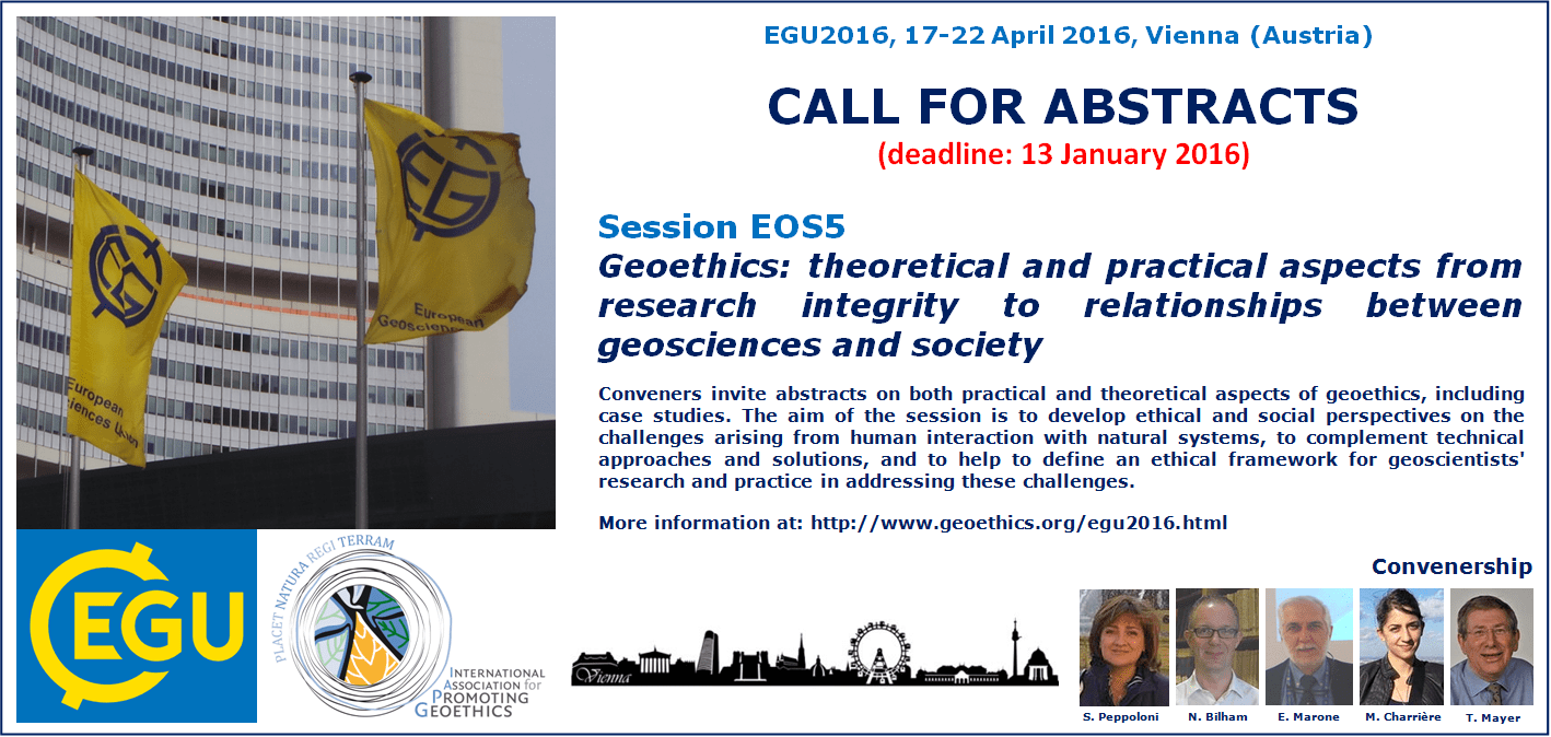
In a few days and the deadline for submitting an abstract at EGU General Assembly 2016 will expire.
It’s time to contribute to the session EOS5 on GEOETHICS (no abstract fee charges!).
Information about this session:
EGU – General Assembly (Vienna 17-22 April 2016)
Session EOS5:
Geoethics: theoretical and practical aspects from research integrity to relationships between geosciences and society
Convener: Silvia Peppoloni
Co-conveners: Nic Bilham, Eduardo Marone, Marie Charriere, Tony Mayer
The conveners invite abstracts on both practical and theoretical aspects of geoethics, including case studies. The aim of the session is to develop ethical and social perspectives on the challenges arising from human interaction with natural systems, to complement technical approaches and solutions, and to help to define an ethical framework for geoscientists’ research and practice in addressing these challenges.
Full description of the session EOS5 at: http://www.geoethics.org/egu2016.html
The session is organized by the IAPG – International Association for Promoting Geoethics (http://www.geoethics.org) in collaboration with the Geological Society of London.
Abstract submission: http://meetingorganizer.copernicus.org/EGU2016/session/20171
Deadline: 13 January 2016
No Abstract Processing Charges!
The December quarter 2015 Australian Geoscientist Employment Survey is now open for submissions. In view of the holiday season, the survey will receive submissions until 29th January.
Please use the embedded survey form (below – requires Java) or follow this link if you experience any problems.
Sincere thanks for your ongoing support of this initiative.
Geoscience Australia is applying specialist geophysical knowledge and capability in the search for missing flight MH370.
Geoscience Australia provides advice, expertise and support to the Australian Transportation Safety Bureau in sea floor mapping (bathymetric survey) and the underwater search.
The data acquired as part of the bathymetric survey has been collected for the sole purpose of finding the missing plane and to bring closure to the families of those on-board. However, as it is some of the first high resolution data available in these areas, it is of great interest to the scientific community and will be released to the public by Geoscience Australia in due course.
The search for MH370 includes a bathymetric survey, providing a detailed map of the sea floor topography of the search area; and an underwater search using scanning equipment or towed submersible vehicles. The information gained in the bathymetric survey is used to build a map of the sea floor in the search area, aiding navigation during the underwater search.
Bathymetric surveys were conducted from May to December 2014, collecting data over 200,000 square kilometres in the search area and producing high resolution maps of the sea floor to safely conduct the underwater search.
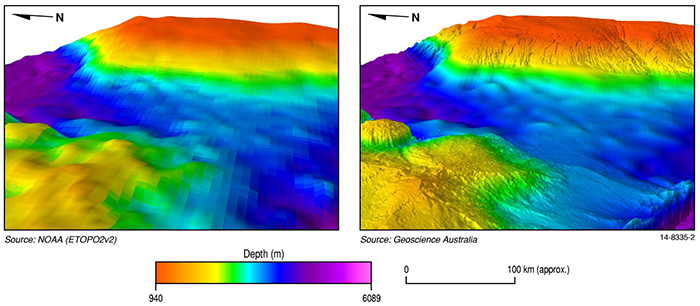
Survey vessels undertaking the bathymetric survey used a multibeam sonarmounted on the hull to obtain measurements and produce a map charting the water depth and hardness of the sea floor. High resolution multibeam data acquisition is time-consuming. It is a little like mowing grass, where bathymetry is mapped line by line.
In general, the world’s deep oceans have had little exploration. Previous maps of the sea floor in the search area were derived from satellites and only indicated the depth of the ocean at a coarse resolution, not showing the shape of the sea floor in enough detail for safe navigation of underwater vehicles. These coarse maps provide data at a low resolution of approximately 1500 metres (per pixel), while the recent multibeam bathymetric survey collected data at 40 to 110 metres (per pixel). This newly acquired data is some of the first high resolution data available for these areas.
Find out more via the Geoscience Australia website.
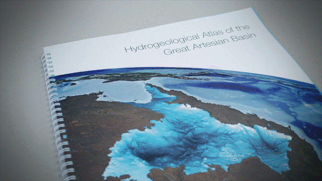
Geoscience Australia has recently released the most comprehensive mapping report on Australia’s largest groundwater basin.
The report has been developed in the form of an Atlas – providing valuable information to assist water managers and communities to make more informed decisions towards sustainable management of this vast water resource. The Hydrogeological Atlas of the Great Artesian Basin (Basin) draws together geological and hydrogeological data collected from the area and condenses it into a series of 55 maps, making the information much more accessible to water managers, researchers, industry, farmers, community groups and the general public.
Australia is the driest inhabited continent on the Earth and, per capita, is one of the largest users of water in the world. Australia draws upon a combination of surface water and groundwater for agriculture production, industry (including mining activities), and town and domestic supply. In many parts of Australia, groundwater is the only reliable water resource, and careful planning and management is critical to ensure sustainable use of this valuable water supply.
 The Great Artesian Basin covers most of Queensland, the north western parts of New South Wales, part of the Northern Territory and about half of South Australia. The Great Artesian Basin is Australia’s largest groundwater system. Comprising around 20% of Australia’s total landmass, the Basin covers most of Queensland, the north western parts of New South Wales, part of the Northern Territory and about half of South Australia. It is estimated to hold nearly 65,000 million megalitres of water, (about 130,000 Sydney Harbours) and is a key source of water for springs, many of which support unique ecosystems.
Find out more about the Atlas and its development here.